- $12bn infrastructure programme requiring coordination to ensure New Zealand's capital city remains a great place to live, work and play
- Engagement with key stakeholders critical to the success of the NFWV implementation
- Successful project sequencing leading to less public disruption and prolonged asset life
- Data visualisation tools created to help identify pinchpoints on key routes
Wellington is a busy and bustling city undergoing a period of significant growth, and as New Zealand’s capital it’s critical that the city develops whilst continuing to be a great place to live, work and play. With approximately $12bn being spent in the next decade on network infrastructure and resilience, works requiring access to the road corridor could significantly obstruct the city from functioning, a risk Wellington City Council wanted to mitigate. The National Forward Works Viewer allows WCC to coordinate and maximise opportunities to sequence works and ensure that if work is happening, other parties can work at the same time. This also means that any potential disruption can be managed within a shorter timeframe, so it isn’t prolonged for the city. Denise Beazley, Network Activity Planning Manager at WCC, spearheaded the project to embed the NFWV into the council’s workstreams.
Engagement is key
WCC began to use the NFWV in early 2020, embarking on a 12-month change management programme to identify, engage and onboard stakeholders and external parties, such as water, gas, electricity and transport infrastructure projects. Making the most of lockdown, the engagement project was mostly carried out over video calls with Denise explaining the existing risks and how to mitigate them using the NFWV, and Angus Bargh (NFWV team) explaining the technical details to the various external parties.
We couldn’t have implemented and onboarded all the different parties without Angus, he’s not only a technical expert, he has an amazing way of engaging with people and his style, approach and responsiveness have been second to none" DENISE BEAZLEY, NETWORK ACTIVITY MANAGER
Proving its worth
|
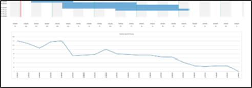
WCC act as the steward for the road corridor across the city and by using the NFWV, they have a single-source oversight of all planned infrastructure works. Early in the implementation phase, the NFWV proved its worth when it identified a possible risk: multiple projects from multiple contractors were planned on the same stretch of road - a road that happens to be a critical connector route outside of the Beehive, NZ's parliament. It highlighted the importance of collaboration and coordination so that the work did not impede parliament, pedestrian access, local businesses and traffic flow.
|
Additionally it has enabled water and roading projects to benefit from the visibility of planning and coordinating programmes. Water projects in Karori were able to be completed prior to the kerb, channel and planned resurfacing works. The kerb and channel has a long life expectancy, so sequencing the projects in this way enabled WCC and Wellington Water to coordinate in a way that saved money. Longer term, it has also enabled the planning of major projects which are often 10+ years in the future. Project managers are able to consider how to dovetail into other projects, and understand service needs for other projects.
Harnessing the data
Initially work was input manually using the inbuilt form on NFWV, but since then the NFWV technical team have developed data interfaces which collect the programme data from stakeholders automatically, decreasing the workload for project planners and increasing the reliability of the data. Critical pieces of work are uploaded and it’s used often used by stakeholders as a test platform to ensure there’s no clashes before they finalise their programme of works.
The data collected so far has been immensely useful, and with the data available our technical partners have created a suite of heatmap models to identify the economic impacts of roadworks across the city in addition to areas which face significant coordination risks. The more data that’s in NFWV, the more we can do with it – and it’s pretty useful stuff!
The data collected so far has been immensely useful, and with the data available our technical partners have created a suite of heatmap models to identify the economic impacts of roadworks across the city in addition to areas which face significant coordination risks. The more data that’s in NFWV, the more we can do with it – and it’s pretty useful stuff!


